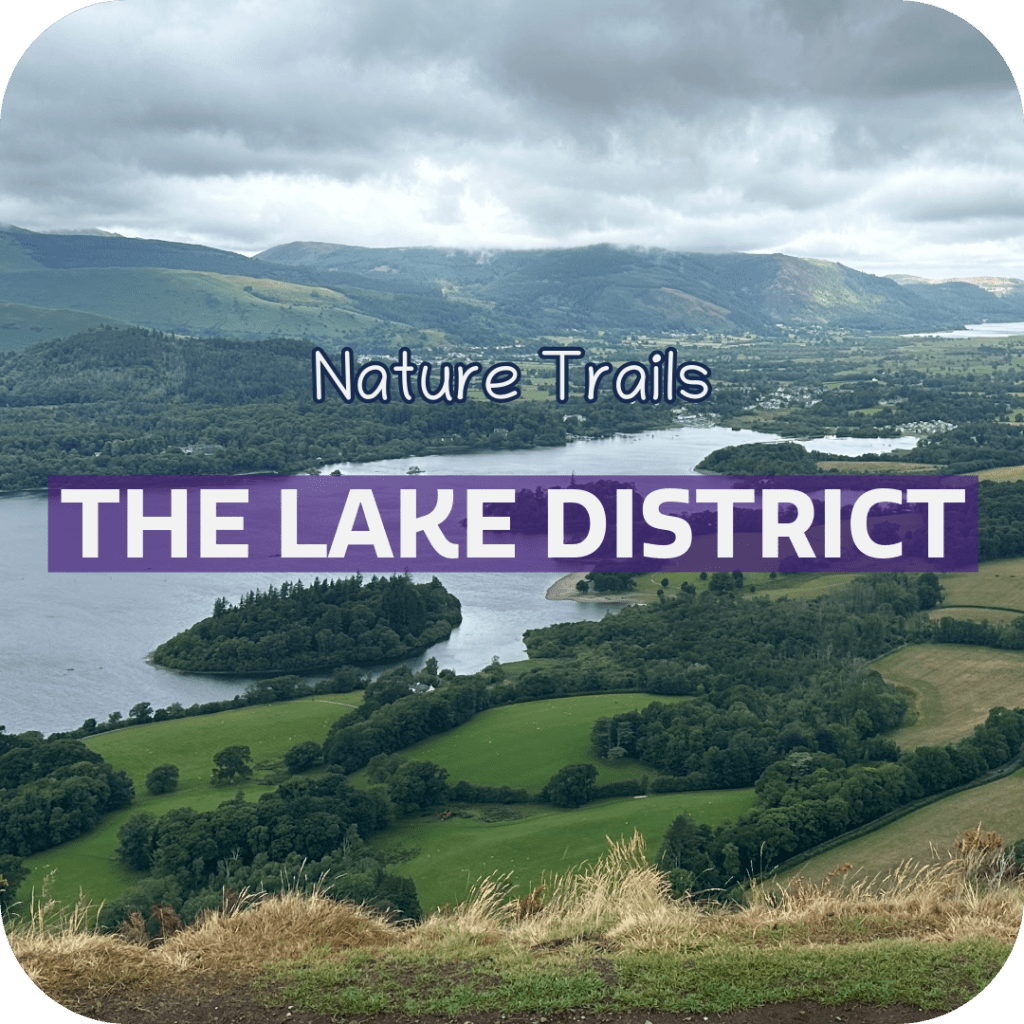
The Lake District is a beautiful region of the UK, with plenty of beautiful hikes, stunning landscapes and bustling towns. I personally love it here, so I’ve crafted this guide to include popular hikes and my favourite nature trails in each region.
Bowness on Windermere, Windermere, Ambleside
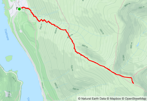
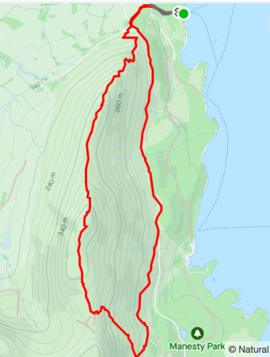
Helvellyn
Helvellyn is the third highest mountain in the Lake District, and offers a challenging hike with rewarding views. There are multiple paths, but I’ve only done the classic route detailed below.
Starting point: Swirls Car Park
Distance: 5 miles/8 km return, 2578 ft/785 m elevation gain.
Time: 3 – 5 hours depending on breaks
Difficulty: Challenging. The hike is steep and has sections of scrambling.
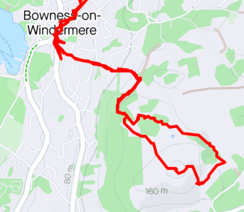
Brant Fell
Brant Fell is accessible from the town of Bowness on Windermere, and is a relatively shorter hike, popular for it’s panoramic view of the Lake District from the summit.
Starting point: Bowness on Windermere
Distance: 4 miles/6.4 km return, 679 ft/206 m elevation gain.
Time: 1.5 – 3 hours
Difficulty: Moderate
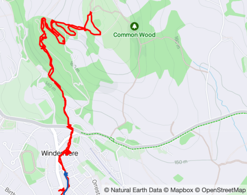
Orrest Head
Orrest Head is a popular route accessible from Windermere, with gentle elevation gain, and pretty views of the Lakes.
Starting point: Windermere
Distance: 2.5 miles/4 km return, 523 ft/159 m elevation gain.
Time: 1.5 hours
Difficulty: Moderate
Stock Ghyll Force Waterfalls
Stock Ghyll Force Waterfalls is a beautiful short and gentle route through scenic woodland paths.
Starting point: Ambleside
Distance: 1.4 miles/2.3 km return, 285 ft/87 m elevation gain.
Time: Less than 1 hour.
Difficulty: Easy.
Rydal Cave
Rydal Water and Cave Circular walk offers a beautiful loop around the lake, with the added bonus of a unique cave you can go in an explore (at your own risk).
Starting point: White Moss Car Park
Distance: 3.1 miles/5 km return, 646 ft/197 m elevation gain.
Time: 1.5 – 2 hours
Difficulty: Easy/Moderate
Keswick
Catbells
Catbells involves a circular walk in the Lake District, with the start point accessible from Keswick via a fun boat journey across the lake.
Starting point: Hawes End jetty
Distance: 4.7 miles/9.5 km return, 1,436 ft/438 m elevation gain.
Time: 2-3.5 hours
Difficulty: Moderate
Walla Crag
Walla Crag is a varied route with a mix of woodland and lakeside hiking. With beautiful views and landscapes, it’s a perfect hike to go on when you are based in Keswick.
Starting point: Keswick
Distance: 7.5 miles/12 km return, 1,131 ft/344 m elevation gain.
Time: 3.5 – 5.5 hours
Difficulty: Moderate

Coniston
Old Man of Coniston/Dow Crag Circular route
The Old Man of Coniston is one of my favourite hikes in the district, with it’s beautiful views and interesting landmarks. While you can go out and back to and from the car park for a shorter route, we decided to make it a circular walk so we had a full day of it, albeit with very sore feet near the end.
Recommended accommodation (aff link): we stayed in High Dow Crag, a beautiful one bedroom apartment, just outside of Coniston. We had an allocated parking space, and beautiful views onto farmers fields. The apartment was stunning, clean, and had everything we needed for an extremely comfortable stay.
Starting point: Accessible on foot from Coniston, but there is a car park available closer to the start (Walna Scar). As you can see from the map, we started the walk right from our accommodation at High Dow Crag.
Distance: 9.4 miles/15 km return, 3,135 ft/955 m elevation gain
Time: 5-7 hours
Difficulty: Challenging.
Map/more information:

Scafell Pike
Scafell Pike is the highest mountain in England, and a great bucket list item. While it’s incredibly rewarding to complete such a challenge, I must say, based on the views, it wasn’t my favourite in the Lakes (*gasp*). This is purely because I love a good mixed landscape, but this is essentially a rocky path the whole way up lol. Nonetheless, it’s worth it for the accomplishment!
Also, it’s an hour away from Coniston, but this was the only place we could find accomodation. There are campsites and various B&B’s scattered across the area, but no town like Windermere or Keswick that I’m aware of.
Starting point: Wasdale Lake Head Car Park
Distance: 5.5 miles/8.8km return, 2,983 ft/909 m elevation gain.
Time: 4-6 hours
Difficulty: Challenging

Or, if you aren’t so inclined to undertake a big hike, check out the following tours in the Lake District (affiliate links)
- Lake District: Ten Lakes Full-Day Tour
- From Manchester: Lake District Bus Tour & Windermere Cruise
- From Liverpool: Lake District Sightseeing Adventure Day Trip
- Lake District: Langdale Valley and Coniston Half-Day Tour
Thank you for reading! I hope you’ve been inspired for your next trip to the Lake District!
Love, Lydia x

Leave a reply to Travel Guide: One Week Itinerary in Bowness on Windermere, The Lake District – LYDIA KERR Cancel reply